Showing posts with label Saratoga National Historical Park. Show all posts

Friday, May 1, 2015

Saratoga National Battlefield Road

I had been waiting...
April 9th the park gates opened to Park Tour Road and the National Park Service announced park fees would not be collected until May 1st. Knowing this, I had to make it back to Saratoga National Historical Park before the crowds started rushing in.

Being able to drive the nine mile loop gave me access to places in the park I had never seen before. I decided to stop at all 10 stops along the Tour Road. For a quick reference map... Click Here!

While I was doing the tour, taking pictures and reading signs, I was surprised. Not by how many people were at the park, but rather that they weren't taking the time to get out of their cars and explore. Every stop is wheelchair accessible. It was difficult for me to figure out why they’d be at a park if they had no intention of actually being there.

12/19/2014 - My first visit to the Saratoga Battlefield I was able to hike from the old entrance near the Neilson Farm (Stop 2) to the Freeman Farm Overlook (Stop 1).
For my story, if you haven't read it... Click Here!

01/03/2015 - My second visit I hiked the length of the Wilkinson National Recreational Trail and was able to see Breymann Redoubt (Stop 7) and Balcarres Redoubt (Stop 6).
For my story, if you haven't read it... Click Here!

01/10/2015 - My third visit began at the Neilson House (Stop 2) and then down to Bemis Heights: American River Fortifications (Stop 3).
For my story, if you haven't read it... Click Here!

With Saratoga National Battlefield Road open and the snow gone I was able to see Stops 4, 5, 8, 9, and 10!
I took my time and hiked all around Balcarres Redoubt (Stop 6) and Fraser Burial Site and Trail (Stop 10).

Stop 1 – The Freeman Farm Overlook
View from Freeman Farm Overlook. I took a picture from this same vantage point my first visit to the park. In this photo, you can see the stretch of Park Tour Road between Stops 5 & 6.
For a comparison photo from my first visit... Click Here!

Stop 2 – Neilson Farm
Neilson House, April 27, 2015. I love this little house.

Stop 3 – American River Fortifications
Here I noticed the Hudson River glimmering in the distance. A thread a water running through the landscape so clear I giggled to myself remembering how badly I had tried to see it in the winter. I was pleasantly surprised to see it right where I believed it should have been. It had been frozen and the whole landscape was absolutely bitter in January.

While I was taking this photo... a little bird scared me. Swooping at my head, making angry noises. I could hear the feathers on its wings flapping the air violently around my head! I had the idea that I came too close to the bird's nest. So after a few swoops from the bird and a few shrieks out of me, I moved away from the cannon and let the little bird be. 

I always try to identify different birds when I'm out hiking. I try to take note of wing shape, tail feather splay, the body size, neck length, and flight pattern. The most I can be sure of is this little bird was Swallow like. With the help of allaboutbirds.org, my best guess is a Barn Swallow.

Again I was seeing, straight in front of me, the Hudson River. I was excitedly expecting to be right next to the Hudson further down the tour road...

I didn't hike the full trails at this stop this time. I had been down the south path during my third visit to the park so I just did a quick photo taking walk. Plus, I really didn't want to risk disturbing that poor little bird again.

Stop 4 – Chatfield Farm
This landscape is so vast. In this photo you can see the tour road leading towards Stop 5. You can also see the Visitors Center up on a hill towards the right side of the photo. I had never made it to this stop before. I imagine this is where I saw the hawk soaring my first visit. Just a wide open field, that gently rolled underneath its winter blanket of snow.

A sign nearby read, "ASA CHATFIELD FARM The farmhouse which stood near here was used as an American observation post."

Stop 5 – Barber Wheatfield
Another stop I was seeing for the first time. I hiked all around and read the signs. On the other side of this field is the little cannon I was so please to see my first visit. 

The left sign reads, "At the height of the fighting in the Barber Wheat Field, when New Hampshire Continentals overran two British cannons, an excited American officer, Colonel Joseph Cilly, leaped upon one of the smoking guns to claim it for the Patriots' cause."

The center sign reads, "THE BATTLE BEGINS AT BARBER'S WHEAT FIELD The fighting began where you now stand and in the woods behind you in mid-afternoon of October 7, 1777. Within minutes, more than 4,000 men collided in savage combat along a line stretching westward across the Barber Wheat Field in front of you and into the clearing on the far hillside. This panorama recreates the struggle at the moment the Americans gained the advantage. In the foreground, Patriots pour murderous volleys into the retreating British Grenadiers. Smoke in the far distance marks the crumbling British right flank. In the middle ground, though still fighting valiantly, German and English ranks are giving way to the American onslaught." 

The right sign reads, "As the carnage in the Barber Wheat Field neared an end, Brigadier General Simon Fraser was struck by a rifle ball while directing a holding action to cover the retreat. Grievously wounded, the brave British general was carried from the battlefield."

I took this photo from the center of the battle line. It is always hard for me to imagine people killing and dying here because it is so peaceful. The trail through Barber Wheatfield is on the quick reference map I have linked in the beginning of this post.

A sign next to me read, "Under intense pressure from the Massachusetts Continentals and New York and Massachusetts militia, units of the German Brunswick and Hesse-Hanau regiments were forced back from this site near the center of the battle line." 

The little cannon. Now I know this is Barber Wheatfield. This field is where the Patriots cut off the British from their advancement towards Bemis Heights. 
For a comparison photo from my first visit... Click Here!

Stop 6 – Balcarres Redoubt (Freeman Farm)
Looking east - This photo was taken right after I got out of my car. The Freeman House site would have been on the left side of this landscape. I really thought, for all the photos I've taken at the Saratoga Battlefield that I would have had one somewhere of a sign with the layout of the land at Balcarres Redoubt. To view the sign... Click Here!

The Wilkinson Trail runs through Stop 6 and is accessible year round. You could also follow the Liason Trail to Stop 6 if you didn't want to hike the whole length of the Wilkinson Trail. Both trails are marked on the quick reference map I have linked towards the beginning of this post.

The first time I visited Bloody Knoll I felt it was inappropriate to take a photo where so many casualties occurred. I've thought about it a lot since January and decided if I made it back to the knoll that I would take a photo out of remembrance - for those who have died for our freedom.

Mill Creek in the valley of the Middle Ravine. I came upon this footbridge while exploring a trail. At a junction nearby you can choose to either go towards Chatfield Farm (Stop 4) or towards Barber Wheatfield (Stop 5). This trail is marked on the quick reference map I have linked towards the beginning of this post.

Looking south - In this photo you can see Bloody Knoll on the right behind the cannon. On the left side you can see a portion of the Wilkinson Trail. I took this picture standing where I originally believed the Freeman House and Barn once stood. I still am not 100% sure, but sometimes I speculate that they were actually to the right of where I was standing when I took this photo. There are a few reasons why I thought the house and barn stood on this green patch of land including apple trees, lilac bushes, the ground was level, and inside the British markers that represent the fortifications. Maybe another visit can help me solve my mystery?

Stop 7 – Breymann Redoubt
This stop is accessible from the Wilkinson Trail. Unfortunately, my phone battery was too low to take photos at this stop. I had it charging in my car for other stops I had not yet been to. The Nameless Monument was free from its winter confines. Hopefully, I'll get the opportunity to get a photo before it freezes again. I took the time to read the dedication on the back of the monument and wondered if they would ever put Benedict Arnold's name on it one day, but I suppose even if you helped win the Battle at Saratoga... a traitor is a traitor.

Stop 8 – Burgoyne’s Headquarters
The sign on the left reads, "BURGOYNE'S HEADQUARTERS Scaled in size according to the rank of the occupant, Crown Force officers' tents - or marquees - graced the American wilderness with fluttering pennants, elegant fringe and elaborate awnings and breezeways. The several large, colorful marquees that marked the Headquarters of Lt. General John Burgoyne stood near this site between September 19 and October 7, 1777, together with those of his staff officers and aides."

The sign on the right reads, "MAIN BRITISH ENCAMPMENT In marked contrast to the officers' marquees were hundreds of enlisted men's tents. The main British encampment of some 4,000 soldiers extended from east of Balcarres Redoubt to beyond the crest of the rise in front of you and to your left. Markers in the field before you correspond to the flags in the illustration and indicate the boundaries of a regimental camp. There were seven such regimental camps in this main encampment."

Looking west - I found it interesting that this stop had such limited access as far as exploring was concerned. Unfortunately, there are no paths leading to the different areas of the encampment. Just a path to the observation lookout where the History Now signs were. I honestly did think about just walking onto the field, but I do my best to respect nature and only travel down designated paths. 
Stop 9 – The Great Redoubt
I knew I was going to get closer to the Hudson River! Since my second visit, when I failed to see the Hudson, I've become a little obsessed. I was thrilled to finally make it this close to the river on the hillside in the park. When I looked down I noticed a sign at the bottom of the hill.

Looking north - From this viewpoint I saw trails. I tried to figure out where the trails started and noticed red and white markers on the next peak over on the hillside. I was determined to read all the signs so I continued to the next stop. The views along the river here were amazing.
A sign nearby read, "THE RIVER REDOUBTS On these bluffs the British constructed three redoubts to protect their artillery park and hospital, located on the river flats below."

Stop 10 – Fraser Burial Site and Trail
The sign reads, "BURIAL SITE OF GENERAL FRASER The British General Simon  Fraser, mortally wounded during the battle of October 7, 1777, was buried near this site the following day."

The trail 

I walked straight forward from the sign about General Fraser and took this photo. The Hudson River from the viewpoint of where a cannon once stood. You can also see US Route 4 NY, which existed during the Revolutionary War as the only road from Montreal to Albany. There are layers of history along the banks of the Hudson River. You can also see the Old Champlain Canal, constructed in the 1820's.

I was standing below the hill (Stop 9), on the river flats facing east when I took this photo. Remains of the Old Champlain Canal, US 4, and the Hudson River can be seen here. To see a sketch of the British encampment along the bluffs... Click Here!

Looking east - In this photo you can see remains of the Champlain Canal, US 4, and the Hudson River. Behind me, the Taylor Cabin once stood. I was fascinated by the old canal... no surprise really, but it distracted me from paying attention to the signs about the British.

A sign nearby read, "SITE OF THE TAYLOR CABIN Grievously wounded, General Simon Fraser was carried here to the Taylor Cabin, which had been taken over as a residence by Baroness Riedesel, the wife of the German Commander. The bleeding general was brought into the room, where a cheerful dinner party to which he had been invited was being held. Simon Fraser died at 8 o'clock on the morning of October 8, 1777.

End of the Park Tour Road. 
At this point... there is very little left for me to explore as far as trails are concerned. Overall, I've hiked approximately fifteen miles in the park and I would certainly visit again. I think now that I've seen all the landmarks I could do more serious hiking without being distracted by the history. Although I know I’ll always get distracted by nature.

An interesting side note - On April 29th, the park began prescribed burns. I know they began with the hillside at Stop 9 and that they also have been working at Stop 3. I learned this from following Saratoga National Historical Park on Facebook. It is updated often. Even throughout the winter. To see the Park's Facebook Page... Click Here!

Stillwater, New York - April 27th 2015
For a large collection of photos taken by me at Saratoga National Historical Park... Click Here!

Sunday, January 18, 2015

Bemis Heights: American River Fortifications

Another exciting exploration at the Saratoga National Historical Park!

We started the day with the intent of hiking by the Hudson River.

After my second visit to the Saratoga Battlefield
I learned about the Park Entrance off of Route 4.
I learned about the Fraser Burial Site Trail.
... but I didn't know the only way to get to the Trailhead is through the Park.

Tour Park Road.
... currently closed until April.

Change of Plans.

We stopped by the Visitor Center.
Used the bathroom.
Becky and Andrew got to look around the little museum in the Visitor Center.
... and then we decided to hike near the Neilson House.

It was Bright.
It was Cold.
it was so cold

The Wind
up at the highest point
of Bemis Heights
where the Neilson House stands
the wind up there
the wind
was
absolutely
brutal.

We didn't stay up at the top too long.

It had been snowing.
That’s what it does this time of year in Upstate New York.
... snow.
The first time I went to the Neilson House
I couldn't even find the Park Road going down towards the American River Fortifications.
... because there was so much snow.

Snow drifts and a little melting made it possible to follow the Park Road.
We did hike through plenty of snow.
... approximately 3.5 miles.

Something I noticed...
The Neilson Farm
Bemis Heights
The American Encampment
... the lay of the land
it was different.
Different from the Freeman Farm.

I remember the Freeman Farm being hilly.
Rolling Hills.
The Neilson Farm...
swept down from the house
down to the bluffs
overlooking
the only road
during the American Revolution
from Montreal to Albany.

We didn't get down to the Hudson River.
I couldn't even see it.
I was disappointed.
... again.

We did get to see hawks!
screeching
soaring
dancing in flight.

We also saw many tracks of animals in the snow.
a funny moment...
we were walking along and I saw strange patterns in the snow.
my brain couldn't put it into a category I recognized!
it was textured
scaly...
I was thinking...
snow snake?
that's impossible!
as I continued to try to figure it out
I noticed...
it was actually the imprint of a Pine Cone
rolling down a slight slope where we stood.
Snow Snake...

Walking along the bluffs of Bemis Heights was pretty amazing.
I was so excited to be outside
that I didn't read any of the plaques
which is just...
really strange for me.
I do believe Nathan read them all.

Hiking back from the American River Fortification
we all agreed it would be best
if we didn't retrace our path down to the bluffs
... but instead
go straight up the hill of the Old Neilson Farm.
Up to the Neilson House.

I stopped several times walking up to the Neilson House.
... taking pictures
... breathing in the beauty and peacefulness

I started back up the hill.
Nathan, Becky, and Andrew were already at the top
... and much to my surprise
They Were Throwing Snowballs At Me!

I must say the snowballs coming towards me
added even more perspective to what it might be like
advancing on a camp.

I've come to really enjoy snow hiking.
I've hiked close to 12 miles in the Saratoga National Historical Park now.
... and I still have quite a ways to hike in the British Encampment.
... by the Hudson River.
I will get there.
I will.

Neilson House.
View from Bemis Heights.
Cannon, crane, and mount...
Cannon.
Neilson House.
The snow makes it difficult to see the American Fortification markers.
Red Tail Hawk soaring.
Just a view I enjoyed.
Nathan, Becky, and Andrew at the Neilson House.
A map of Saratoga National Historical Park.
I got this map from a Ranger at the Visitor Center.


Stillwater, NY - January 10th 2015

Thursday, January 8, 2015

Wilkinson National Recreational Trail

Since my first visit to the Saratoga National Historical Park
I've wanted to hike the Wilkinson Trail.

The Wilkinson National Recreational Trail is a 4.2 mile "lasso" path.
It's located in the northern part of the Saratoga Battlefield.

The Liaison Trail (a shorter hike)
-from Breymann Redoubt
-to Balcarres Redoubt
excludes a good portion of the Wilkinson Trail (two miles)
but it does take you to the Freeman Farm. 

I wanted to do the whole trail.
I had somehow got the impression 
if I did the whole hike...
I would get to see the Hudson River.

I was wrong...
but this gives me another opportunity to explore the park farther.
Saratoga Battlefield.
My first hike of the New Year! 
I was so excited to return to the Saratoga Battlefield with Nathan.

It was cold out...
but not unbearable.
Snow wasn't falling... 
and the wind was mostly calm.

We knew hiking the whole length of the trail would take a couple hours.
So we got out of the house early.
The days are getting longer...
but darkness still arrives faster than one expects.

Gently rolling hills. 
Sporadic forests.
Expansive fields.

Nathan and I both enjoyed the absence of people.
(the best thing about hiking off season)
When we did see other humans they were near the cannons and memorials.
I do not believe most people hike the whole Wilkinson Trail.
Cannon.

As we walked...
we of course talked about the landscape.
Its contribution to how the battles were fought.
We talked about what it might be like to be a part of the war...
the quality of weapons
the quality of life
the real idea of the blood that was shed 
... horrifying.

The Freeman Farm 
"the battlefield" 

When Nathan and I came upon the area 
where the Freeman farmhouse once stood 
I saw cannons everywhere.

Immediately I knew this was the area! 
The top of the snowy field
with the plaques
and the cannons...
The place I couldn't reach my first visit to the park.
... due to snow.

I started looking up 
to see if I could make out 
the lookout where I first saw 
the Freeman Farm.
I got so excited.
I saw the marvelous trees!!! 
Even from down on the battlefield the trees stood out.

The battlefield with no snow was surprisingly different.

I think Nathan and I were in need of a long walk.
He stopped and read the plaques.
He explained things to me about the Revolutionary War.
His enthusiasm was refreshing.
Looking down a ravine from the trail.
I'm not sure if it's the time of year...
but in the wooded areas...
I had the impression... 
I would get lost if I was by myself.
... directionally challenged.
Everywhere I looked was deceptively similar.
Lucky for me the trail is very well marked.

I recommend getting a Wilkinson Trail map available at the Visitor Center. 
The Wilkinson Trail brochure is great to have during the hike around the British Encampment. 
It has a list of interpretive stations
-A through N
explaining events of the Battle of Saratoga.

I enjoyed the interpretive stations.
During a walk that’s a little over 4 miles it’s nice to stop. 
look around...
and gain knowledge of the history beneath one's feet.

"Bloody Knoll" at Balcarres Redoubt.
Not really mentioned on the internet.
Nothing noting its location in my Wilkinson Trail brochure.
Yet I believe I read, the knoll is where the most casualties in the battle occurred.
I kind of wish I had done it now...
but I didn't take pictures.

After collecting information from the Visitor Center on my first visit
brochures...
maps...
I thought it would be easy to find information about Wilkinson National Recreational Trail on the internet.

There are lots of maps to be found.
Maps of where the trail is.
Maps of how to get there.
but no real information about hiking the trail itself.
I do own a book with detailed information about the hike.
I also have a map of the trail that I got from the Park Ranger...
but even the National Park Service website didn't have Wilkinson Trail information.

Lots of historical information on the battle...
but not much about the path through history.

I do highly recommend going to the Visitor Center before exploring.
They have excellent maps and historical information.
A timeline museum.
A battle tactic map with lights showing movements of troops.
Cannons.
And a public restroom.

Nathan and I ended up walking 5 miles.
We had an excellent time exploring the British Encampment.
We were out on the trail for about 2 1/2  hours.
We went into the Visitor Center briefly after we finished walking.
I thought Nathan might enjoy a quick look at the weapons.
Just as we left the Visitors Center...
it started snowing.

Behind the Visitor Center heading towards the Wilkinson Trailhead.
Overlooking Saratoga Battlefield.
Cannon at Balcarres Redoubt.
Many cannons are displayed in this area.
Cannon at Breymann Redoubt.
Flax was farmed on this field back in 1777.
Path used by the British Army.
Hessian soldier route.
The Hessian soldiers advancing would have crossed a bridge here.
Nathan on the path where the Hessian soldiers advanced.
Battlefield view from British fortifications.
The Freeman Farm. 
One last look.
Back at the Visitor Center.
Brochure I got from the Visitor Center.
Wilkinson Trail map in the brochure.
Hiking in New York: A Guide to the State's Best Hiking Adventures

Stillwater, NY - January 3rd 2015

Saturday, December 20, 2014

Saratoga National Historical Park

It being off season, Saratoga National Battlefield Road was closed.
I accidentally walked four miles and I only got to see two points of interest.  
Neilson Farm
Freeman Farm Overlook

Neilson was a patriot.
Freeman was a loyalist.

I started at a park entrance by the Neilson House.
I saw a little red house at the top of a hill. 
Excited, I ran up to see it closer.

I wanted to see as much as I could before the sun went down. 
The winter solstice is near.
Lately the sun seems to be constantly setting. 
The clouds were moody with hues of blue. 
The air was crisp with hints of renewal.
I felt happy as I walked and pondered... 
how many people died here?

It was completely peaceful. 
I admit it was difficult to imagine anyone ever dying in the fields.

I saw ten deer and one hawk throughout my walk.
At one point I saw a marker and decided it was time to turn around. 

Apparently, I was so excited about the hawk... 

that I continued walking in the same direction. 
I had watched and followed the hawk for a short time.
About the time I thought I should be nearing where I first saw the hawk...
I saw a cannon off in the distance.
I was so confused.
How did I miss this the first time? 


I continued on...
Still thinking I had turned around...
and came upon an area with marvelous looking trees. 

Naked, the trees elegantly reached for the sky.
I noticed a little paved loop and... 
I was really confused.
I walked around and saw where the first battle took place.

I was at the Freeman Farm Overlook.
After reading all the plaques I took out my gps.
I never turned around at the marker as I had intended. 
I felt silly. 
I am directionally challenged. 
It’s comical at times. 

I headed back to where I had parked. 
Taking in all the beauty nature had to offer me.

Honestly, I didn't feel like I got to see much of the park at all. 
I decided to go to the visitors center. 
It was an excellent choice. 
I learned so much from a volunteer ranger. 
He showed me a video explaining everything about the battle tactics involved and why the Americans won. 
The visitors center had a room full of artifacts complimenting an entire timeline of the revolutionary war. 

what intrigued me?
I learned that the bodies were buried where they lay.
Farming resumed on the fields after the war.
At one time, selling bones from the fallen soldiers was common place.
Every once in a while human remains are still found to this day.

I learned there is a trail in the park open year round called the Wilkinson Trail.
It's a 4.2 mile hike that goes around the area the British Army had fortified.
Bemis Heights, where the Neilson Farm was located is the area the American Army had Fortified.

 ~1250 men died at the Battle of Saratoga.

I would definitely visit multiple times to explore and learn.


American Army Encampment.
Neilson House.
Neilson House on the right.
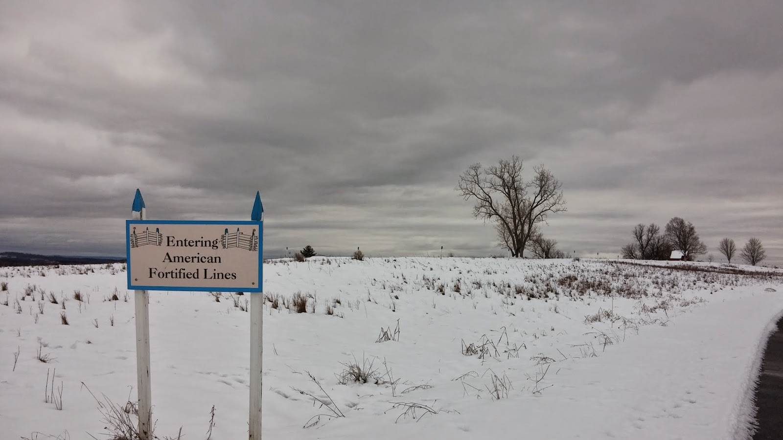
White marker posts show where a wooden wall once stood. Fortified lines on the battlefield.
View from Neilson Farm.
View towards the Hudson River and Bemis Heights from Neilson Farm.
Field where I saw the hawk soaring.
Marker where I intended to turn around.
Cannon off in the distance.
Cannon up close.
Marvelous trees.
View from Freeman Farm Overlook.
There are three deer grazing on the right side of this photo.
View from Freeman Farm Overlook.
This is where the first battle took place.
One last look.
Neilson House is on the left.
And now a few random pictures from the visitors center.
I don't know why but I found this surgical hacksaw fascinating.
Coins.
I learned that often fighting would be physical. Hand to hand combat.
More weapons. 
I found these drawings and theories entertaining and wanted to share.
They were done by Johann Kaspar Lavater, 1792.
Choleric.
Sanguine.
Melancholic.
Phlegmatic.
All information I learned from going to the park. It's a nice way to learn history.

Stillwater, NY - December 19th 2014